Show the map
la Cabanasse--Planes, par train jaune!!
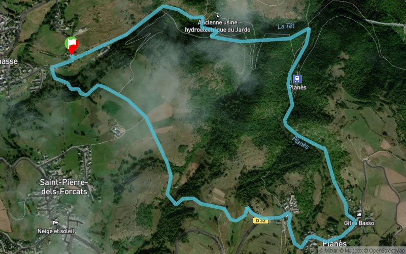


6.1 km
233 m
233 m
 La Cabanasse (66)
 Points of Interest table
| Accum. | Intermediary | |||||||
|---|---|---|---|---|---|---|---|---|
| POI | Description | Alt. | Dist. | D+ | D- | Dist. | D+ | D- |
Trace n°509
Ascent threshold : 0 m Distance threshold : 35 m Smoothing : Yes Origin of altitudes : MNT Aster GDEM
Ascent threshold : 0 m Distance threshold : 35 m Smoothing : Yes Origin of altitudes : MNT Aster GDEM
Loop
Dominant terrain : Footpath
Max alti. : 1512 m
Avg alti. : 1454 m
Min alti. : 1342 m
Longest ascent : 220 m
Longest descent : 75 m
Route completed by the author : nc
Dominant terrain : Footpath
Max alti. : 1512 m
Avg alti. : 1454 m
Min alti. : 1342 m
Longest ascent : 220 m
Longest descent : 75 m
Route completed by the author : nc
Elevation profile
More tools
Create a new roadbook page
Map and track on your website
Warning ! When you insert a Trace de Trail map on your website, you agree not to hide any element of the module (links to Trail Trail or Trail Connect banner)
Add a realisation
Validate
Add a realisation to share your chrono and describe the conditions that you encountered during you trail running !
Add a comment
Validate
Ludosaxo
19/08/18, 10:30:48
Trace très approximative entre La Cabanasse et la montée au village de Planès
19/08/18, 10:30:48
Trace très approximative entre La Cabanasse et la montée au village de Planès
Show the infos
Add a track


