Show the map
Les crêtes de la Hulpe 2018
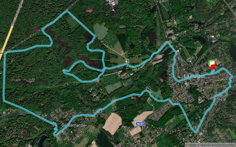


18 km
440 m
450 m
 La Hulpe (BE)
 Points of Interest table
| Accum. | Intermediary | |||||||
|---|---|---|---|---|---|---|---|---|
| POI | Description | Alt. | Dist. | D+ | D- | Dist. | D+ | D- |
 Competition organized on 10/21/2018
Trace n°70743
Ascent threshold : 3 m Distance threshold : 30 m Smoothing : No Origin of altitudes : MNT Aster GDEM
Ascent threshold : 3 m Distance threshold : 30 m Smoothing : No Origin of altitudes : MNT Aster GDEM
Loop
Dominant terrain : Path
Max alti. : 136 m
Avg alti. : 87 m
Min alti. : 49 m
Longest ascent : 70 m
Longest descent : 50 m
Dominant terrain : Path
Max alti. : 136 m
Avg alti. : 87 m
Min alti. : 49 m
Longest ascent : 70 m
Longest descent : 50 m
Elevation profile
More tools
Create a new roadbook page
Map and track on your website
Warning ! When you insert a Trace de Trail map on your website, you agree not to hide any element of the module (links to Trail Trail or Trail Connect banner)
Add a realisation
Validate
Add a realisation to share your chrono and describe the conditions that you encountered during you trail running !
Add a comment
Validate
lvr123
18/09/19, 13:55:14
Bucolique, mais majoritairement bitume, gravier et pavés. Difficulté au km 3,8 où un pont surplombant un petit vallon est interdit de passage. Un peu d'escalade est nécessaire.
18/09/19, 13:55:14
Bucolique, mais majoritairement bitume, gravier et pavés. Difficulté au km 3,8 où un pont surplombant un petit vallon est interdit de passage. Un peu d'escalade est nécessaire.
Show the infos
Add a track


