Show the map
OFFICIAL ROUTE
Trail Blanc des Vosges - 5km Nocturne
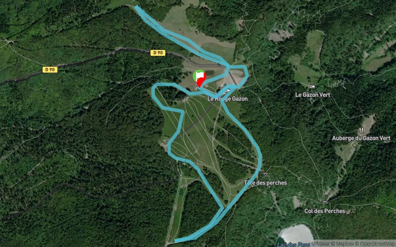


 Station de Rouge Gazon (88) (68)
 Points of Interest table
| Accum. | Intermediary | |||||||
|---|---|---|---|---|---|---|---|---|
| POI | Description | Alt. | Dist. | D+ | D- | Dist. | D+ | D- |
 Competition organized on 01/26/2019
Trace n°14094
Ascent threshold : 3 m Distance threshold : 30 m Smoothing : No Origin of altitudes :
Ascent threshold : 3 m Distance threshold : 30 m Smoothing : No Origin of altitudes :
Loop
Dominant terrain : Path
Max alti. : 1228 m
Avg alti. : 1109 m
Min alti. : 985 m
Longest ascent : 250 m
Longest descent : 150 m
Dominant terrain : Path
Max alti. : 1228 m
Avg alti. : 1109 m
Min alti. : 985 m
Longest ascent : 250 m
Longest descent : 150 m
Elevation profile
More tools
Create a new roadbook page
Map and track on your website
Warning ! When you insert a Trace de Trail map on your website, you agree not to hide any element of the module (links to Trail Trail or Trail Connect banner)
Add a realisation
Validate
Add a realisation to share your chrono and describe the conditions that you encountered during you trail running !
Add a comment
Validate
Show the infos
Add a track


