Show the map
Trail Trèfle Touëtois 2013 - 17 Km & 800 m+
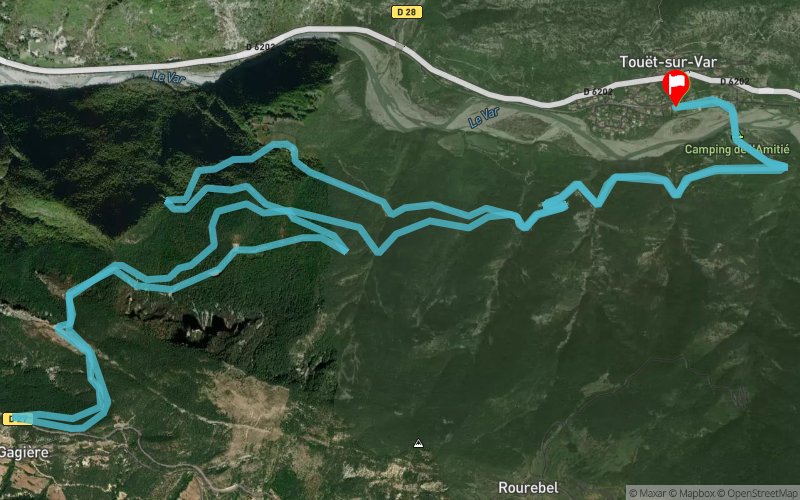


16.7 km
804 m
788 m
 Touët-sur-Var (06)
 Touët-sur-Var (06)
 Points of Interest table
| Accum. | Intermediary | |||||||
|---|---|---|---|---|---|---|---|---|
| POI | Description | Alt. | Dist. | D+ | D- | Dist. | D+ | D- |
 Competition organized on 07/21/2013
Trace n°3710
Ascent threshold : 0 m Distance threshold : 35 m Smoothing : Yes Origin of altitudes : MNT Aster GDEM
Ascent threshold : 0 m Distance threshold : 35 m Smoothing : Yes Origin of altitudes : MNT Aster GDEM
Loop
Dominant terrain : Footpath
Max alti. : 907 m
Avg alti. : 591 m
Min alti. : 302 m
Longest ascent : 710 m
Longest descent : 725 m
Dominant terrain : Footpath
Max alti. : 907 m
Avg alti. : 591 m
Min alti. : 302 m
Longest ascent : 710 m
Longest descent : 725 m
Elevation profile
More tools
Create a new roadbook page
Map and track on your website
Warning ! When you insert a Trace de Trail map on your website, you agree not to hide any element of the module (links to Trail Trail or Trail Connect banner)
Add a realisation
Validate
Add a realisation to share your chrono and describe the conditions that you encountered during you trail running !
Add a comment
Validate
Show the infos
Add a track


