
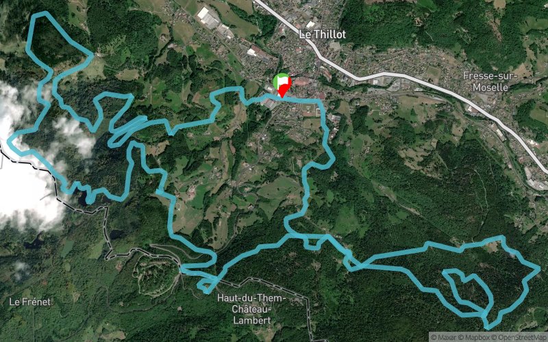
Trail Hautes Mynes 2017
 25.3 km
1150 m
1150 m
25.3 km
1150 m
1150 m
01/10/2017
GPX
203
PDF
Profile
Share
3D
Favorites
Reviews
Like
Le Thillot (88) Le Thillot (88)
Effort kilometer
Longest ascent
Longest descent
36
220 m
170 m
Max. elevation
Min. elevation
Quality index
805 m
484 m
 1pt/74m
Start
Distance
0 km
Altitude
486 m
D+
0 m
D-
0 m
25.3 km
1150 m
1150 m
Finish
Distance
25.3 km
Altitude
486 m
D+
1150 m
D-
1150 m
Click on a point of interest to display it on the map
Reviews and times
Add a track
Trail Hautes Mynes 2017

Track number : 43032
Link to track :
https://tracedetrail.fr/en/trace/43032
Log in to insert this track on your website
 Trace de Trail