
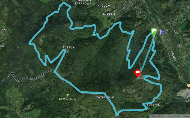
Piek?o Czantorii Maraton 2018
ITRA
 43 km
4010 m
3550 m
43 km
4010 m
3550 m

17/11/2018
GPX
7
PDF
Profile
Share
3D
Favorites
Reviews
1 Like
Ustro? (PL) Wis?a (PL)
Effort kilometer
Longest ascent
Longest descent
83
460 m
500 m
Max. elevation
Min. elevation
Quality index
1003 m
386 m
 1pt/9m
Track created by Misyjny Klub Sportowo-Rekreacyjny Centrum
le 2018/06/14 (modified on 2018/06/19)
le 2018/06/14 (modified on 2018/06/19)

Start
Distance
0 km
Altitude
411 m
D+
0 m
D-
0 m
43 km
4003 m
3548 m
Finish
Distance
43 km
Altitude
867 m
D+
4003 m
D-
3548 m
Click on a point of interest to display it on the map
Reviews and times
dragosmalihin2018/11/18
2018/11/17 08:44:20
2018/11/17 08:44:20
Cold: -4 C in lower parts, -10 C at the upper stations. The paths are not technically interesting/challenging, but very steep and sometimes rocky. Only brief sections in the woods.
Add a track
Piek?o Czantorii Maraton 2018

Track number : 61469
Link to track :
https://tracedetrail.fr/en/trace/61469
Log in to insert this track on your website
 Trace de Trail