Show the map
Trail café Chaulet


15.4 km
1087 m
1089 m
 Saint-Claude (971)
 Points of Interest table
| Accum. | Intermediary | |||||||
|---|---|---|---|---|---|---|---|---|
| POI | Description | Alt. | Dist. | D+ | D- | Dist. | D+ | D- |
 Competition organized on Non spécifiée
Trace n°77
Ascent threshold : 0 m Distance threshold : 35 m Smoothing : Yes Origin of altitudes : MNT Aster GDEM
Ascent threshold : 0 m Distance threshold : 35 m Smoothing : Yes Origin of altitudes : MNT Aster GDEM
Loop
Dominant terrain : Footpath
Max alti. : 1438 m
Avg alti. : 879 m
Min alti. : 564 m
Longest ascent : 865 m
Longest descent : 811 m
Dominant terrain : Footpath
Max alti. : 1438 m
Avg alti. : 879 m
Min alti. : 564 m
Longest ascent : 865 m
Longest descent : 811 m
Elevation profile
More tools
Create a new roadbook page
Map and track on your website
Warning ! When you insert a Trace de Trail map on your website, you agree not to hide any element of the module (links to Trail Trail or Trail Connect banner)
Add a realisation
Validate
Add a realisation to share your chrono and describe the conditions that you encountered during you trail running !
Add a comment
Validate
Admin - Trace de Trail
24/01/13, 10:17:07
Salut David,
24/01/13, 10:17:07
Salut David,
Oui, malheureusement je n'ai pas pu le faire, c'était un peu compliqué pour m'organiser... Mais je crois que je vais être content de recourir dans la neige !
daviddepardon
20/01/13, 13:17:18
Salut Jean Phi.
20/01/13, 13:17:18
Salut Jean Phi.
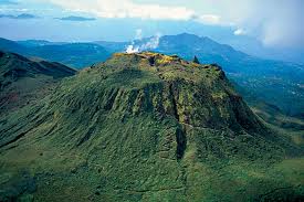
Joli parcours vu du ciel dans les volcans.
Nous on cours dans la neige....
Show the infos
Add a track


