Show the map
OFFICIAL ROUTE
La Diagonale des Yvelines 2019 - Diag78 - 48 km
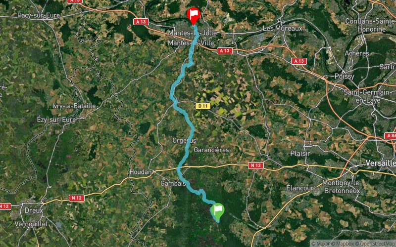


47.1 km
740 m
870 m
 Saint-Léger-en-Yvelines (78)
 Mantes-la-Jolie (78)
 2
2 Points of Interest table
| Accum. | Intermediary | |||||||
|---|---|---|---|---|---|---|---|---|
| POI | Description | Alt. | Dist. | D+ | D- | Dist. | D+ | D- |
 Competition organized on 06/22/2019
Trace n°89379
Ascent threshold : 0 m Distance threshold : 0 m Smoothing : No Origin of altitudes : MNT IGN
Ascent threshold : 0 m Distance threshold : 0 m Smoothing : No Origin of altitudes : MNT IGN
Crossing
Dominant terrain : Path
Max alti. : 184 m
Avg alti. : 103 m
Min alti. : 17 m
Longest ascent : 120 m
Longest descent : 110 m
Dominant terrain : Path
Max alti. : 184 m
Avg alti. : 103 m
Min alti. : 17 m
Longest ascent : 120 m
Longest descent : 110 m
Elevation profile
More tools
Create a new roadbook page
Map and track on your website
Warning ! When you insert a Trace de Trail map on your website, you agree not to hide any element of the module (links to Trail Trail or Trail Connect banner)
Add a realisation
Validate
Add a realisation to share your chrono and describe the conditions that you encountered during you trail running !
Add a comment
Validate
More comments
Lvcasp
17/06/19, 20:15:30
En ajoutant le fichier .gpx sur garmin connect, j'ai le message d'erreur : "Une erreur est survenue lors du transfert. Veuillez réessayer." Si quelq'un a une idée de la solution, je suis preneur.
17/06/19, 20:15:30
En ajoutant le fichier .gpx sur garmin connect, j'ai le message d'erreur : "Une erreur est survenue lors du transfert. Veuillez réessayer." Si quelq'un a une idée de la solution, je suis preneur.
Show the infos
Add a track


