Show the map
Certified Track - ITRA
Týnistke Slapoty 2019 - 130
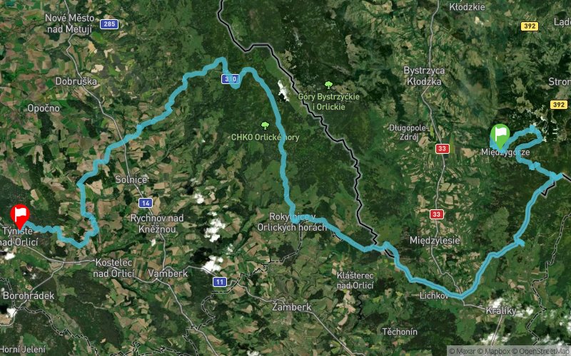


135.5 km
4230 m
4580 m
 Jaworek (PL)
 Týništ? nad Orlicí (CZ)
 4
4 220
220 Points of Interest table
| Accum. | Intermediary | |||||||
|---|---|---|---|---|---|---|---|---|
| POI | Description | Alt. | Dist. | D+ | D- | Dist. | D+ | D- |
 Competition organized on 07/27/2019
Trace n°95086
Ascent threshold : 3 m Distance threshold : 0 m Smoothing : No Origin of altitudes : GPS
Ascent threshold : 3 m Distance threshold : 0 m Smoothing : No Origin of altitudes : GPS
Crossing
Dominant terrain : Footpath
Max alti. : 1367 m
Avg alti. : 687 m
Min alti. : 204 m
Longest ascent : 700 m
Longest descent : 830 m
Dominant terrain : Footpath
Max alti. : 1367 m
Avg alti. : 687 m
Min alti. : 204 m
Longest ascent : 700 m
Longest descent : 830 m
Elevation profile
More tools
Create a new roadbook page
Map and track on your website
Warning ! When you insert a Trace de Trail map on your website, you agree not to hide any element of the module (links to Trail Trail or Trail Connect banner)
Add a realisation
Validate
Add a realisation to share your chrono and describe the conditions that you encountered during you trail running !
Add a comment
Validate
Show the infos
Warning ! This track is only accessible on the day of the competition.
Add a track


