Show the map
Mont des Cats - Mont Kokereel - Mont Noir
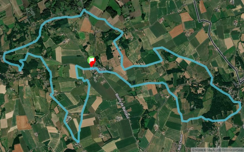


 Berthen (59)
The start is from a small car park in Berthen and the route covers about 18km and passes through four hills in French Flanders. Berthen is located between the Cats mountain, the Boschoepe mountain, the Kokerel mountain and the Black mountain. The town is 6 km from Bailleul, 45 km from Dunkirk and 35 km from Lille.
This trail course consists of 10% forest road, 25% country road, 55% small paved country road and 10% dual carriageway. For us northerners, this route includes beautiful landscapes, but also several inns offering local products (beer, cheese, etc.) and of course tourist spots. For example, the route follows the "sentier des jacinthes", a 6 km path that links the museum to the Marguerite-Yourcenar villa, a writers' residence.
Points of Interest table
| Accum. | Intermediary | |||||||
|---|---|---|---|---|---|---|---|---|
| POI | Description | Alt. | Dist. | D+ | D- | Dist. | D+ | D- |
Trace n°153708
Ascent threshold : 3 m Distance threshold : 30 m Smoothing : Yes Origin of altitudes : MNT IGN
Ascent threshold : 3 m Distance threshold : 30 m Smoothing : Yes Origin of altitudes : MNT IGN
Loop
Dominant terrain : Road
Max alti. : 160 m
Avg alti. : 86 m
Min alti. : 39 m
Longest ascent : 120 m
Longest descent : 110 m
Route completed by the author : Yes
Dominant terrain : Road
Max alti. : 160 m
Avg alti. : 86 m
Min alti. : 39 m
Longest ascent : 120 m
Longest descent : 110 m
Route completed by the author : Yes
Elevation profile
More tools
Create a new roadbook page
Map and track on your website
Warning ! When you insert a Trace de Trail map on your website, you agree not to hide any element of the module (links to Trail Trail or Trail Connect banner)
Add a realisation
Validate
Add a realisation to share your chrono and describe the conditions that you encountered during you trail running !
Add a comment
Validate
Show the infos
Add a track


